A research team led by the Spanish National Research Council published a comprehensive study Thursday describing underground water circulation in Antarctica. The analysis focuses specifically on freshwater lakes on Deception Island, revealing they connect directly to the ocean beneath the surface through permeable volcanic soil. This discovery challenges previous scientific assumptions about hydrogeological systems in polar volcanic environments and suggests complex subsurface dynamics that were previously unknown to the global scientific community, including Chilean researchers.
Researchers found that annual recharge from melting ice and rain equals 41% of total precipitation in the specific region studied during the recent campaigns. The volcanic soil deposits allow water to infiltrate with high efficiency, creating a unique subsurface network that feeds multiple lakes simultaneously without evaporation loss. This mechanism maintains the lakes despite their location within closed volcanic craters near the sea, defying typical expectations for such terrain and water retention capabilities.
The study identifies two interconnected aquifers, one seasonal and one permanent regional system that operates year-round beneath the frozen ground layers. Water circulates easily through volcanic materials in the deeper layer, linking directly to the marine environment through natural pathways and tidal pressures from the ocean. This flow controls lake levels and explains why the water remains fresh despite proximity to saltwater, according to the published findings and detailed hydrological data collected.
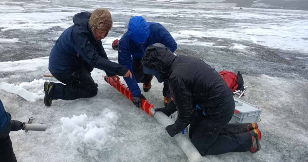
Jorge Jódar from the Geological and Mining Institute of Spain led the investigation during Antarctic campaigns in 2024 and 2025 with a dedicated international team. He stated the work provides the first integral characterization of an aquifer system functioning in Antarctica, marking a significant milestone for polar science and geology. Experts note this model helps anticipate changes caused by global warming and permafrost degradation affecting the island's stability and water quality significantly.
Chilean scientists frequently collaborate on Antarctic research due to the country's significant presence and multiple bases in the region near the studied island. Understanding these hydrological shifts is critical for predicting climate impacts on South American fisheries and national water resources managed by Santiago. The data contributes to broader models used by nations with territorial interests in the continent, including Chilean economic planning agencies monitoring environmental risks and resource management.
Isotopic analysis established the first relationship between precipitation composition and altitude in this sector of the Southern Ocean and Antarctic Peninsula. This allows researchers to reconstruct the origin of water recharging the aquifers from snow and rain based on chemical signatures found in the samples. Improved models assist in interpreting climate records preserved in polar ice sheets globally, enhancing long-term environmental forecasting capabilities for the hemisphere.
The findings suggest that seasonal permafrost dynamics heavily condition the island's hydrological behavior and ecosystem stability in the extreme climate. As temperatures rise, the interaction between freshwater and seawater could shift significantly, altering local biodiversity and chemical balances in the water. This poses risks to local ecosystems and requires updated monitoring strategies for polar regions to protect sensitive environments from rapid climate change.
Future research will apply this method to other Antarctic regions to validate the hydrogeological model across different geological settings and conditions. The study offers a new framework for understanding water systems in extreme volcanic environments that were previously poorly understood by the scientific community. Continued observation remains essential for accurate climate forecasting and environmental protection efforts in the coming decades for all stakeholders.